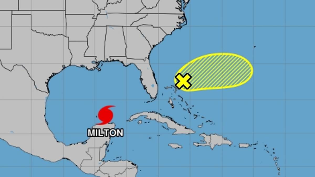
The US National Hurricane Center has identified a potential developing storm, named ‘Nadine,’ emerging hot on the heels of the deadly impending Category 5 Hurricane Milton.
The current ‘non-tropical area of low pressure,’ NHC officials noted, is currently ‘producing gale-force winds’ northeast of the Bahamas at 15 miles per hour.
Right now, this weather front has a 20 percent chance of building into a tropical storm and could develop into a stronger hurricane-force storm before Wednesday night — just as Milton barrels over Florida.
NHC officials described Hurricane Milton as already ‘potentially catastrophic’ for Florida’s western coastal communities all by itself — a clear indication that yet another storm this soon would do unprecedented harm.

The US National Hurricane Center has identified a potential storm (in yellow above) emerging hot on the heels of the deadly Category 5 Hurricane Milton. Right now, this weather front has a 20 percent chance of building into a tropical storm or worse – which would be named ‘Nadine’

Hurricane Milton, currently a catastrophic Category 4 hurricane with winds of 155 mph, continues to churn across the Gulf of Mexico heading for Florida, shown on the GOES-East satellite at 10:09 GMT, October 8, 2024
Fortunately, after Wednesday night, according to NHC hurricane specialist Andrew Hagen, the percentage chance that these gale-force winds will spiral into a still hypothetical Hurricane Nadine are likely to drop dramatically.
‘Upper-level winds are likely to increase by Wednesday night, which should end any chances for further development,’ the longtime NHC marine forecaster wrote in his advisory Tuesday.
According to the National Oceanic and Atmospheric Administration, hurricanes typically develop from tropical waves that combine with warm ocean waters.
Read More
EXCLUSIVE
Hurricane victims driven to suicide in NC as US braces for Milton

Thunderstorms and other atmospheric turbulence can help prod a stormfront into gathering hurricane-force power, as warmer ocean air rises into these storm clouds, creating a low pressure area underneath it.
A hurricane’s maximum sustained wind speed, defined as the highest one-minute average wind speed at a particular point in time, sets the cut-off between these powerful storms and lesser tropical cyclones.
Hurricanes are defined as anything 74 mph or higher. A tropical cyclone is defined by maximum sustained winds between 39 and 73 mph.
Florida residents seeking help are urged to call the State Assistance Information Line (SAIL) at 1-800-342-3557 and/or the FEMA Helpline at 1-800-621-3362.