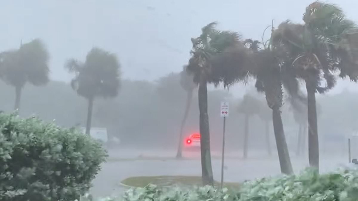
Dangerous, heavy rainfall has swamped the streets of Florida as a tropical disturbance brings a rare flash flood emergency to much of the state.
Devastating downpours and subsequent flooding blocked roads, floated vehicles and left dozens of drivers stranded Wednesday in a storm that some residents have said is unlike anything they have ever experienced before.
The storm turned several roads in south Florida into rivers and lakes, forcing locals to abandoned their cars and wade through the water.
Interstate 95 reopened early this morning after the Florida Highway Patrol closed parts closed parts of the major artery on Wednesday after it became impassable for drivers.
Governor Ron DeSantis has declared a state of emergency for five counties as residents prepare to weather more heavy rainfall today and tomorrow, which forecasters warn could trigger flash floods in central and south Florida.
A tropical disturbance will continue to unleash torrential downpours across Florida today, bringing a rare flash flood emergency to much of the state.
The disorganized storm system was pushing across Florida from the Gulf of Mexico at roughly the same time as the early June start of hurricane season – which this year is forecast to be among the most active in recent memory amid concerns that climate change is increasing storm intensity.
The disturbance has not reached cyclone status and was given only a slight chance to form into a tropical system once it emerges into the Atlantic Ocean after crossing Florida, according to the National Hurricane Center.
‘Regardless of development, heavy rainfall is forecast to continue across portions of the Florida peninsula during the next few days,’ the hurricane center said.
Forecasters predict between 18 and 24 inches of rain will fall across southwestern Florida throughout the course of the storm.
Some radar suggests the region could see up to 30 inches of rainfall, which is typical of a severe slow-moving tropical storm or hurricane.
AccuWeather Meteorologist Bernie Rayno warned that the storm will be ‘like a wall of water coming at southern and central Florida into Thursday’.
‘The steadiest and heaviest rain will fall on South and central Florida through Thursday, but more spotty downpours and thunderstorms will continue to pester the region into Saturday,’ added AccuWeather Senior Meteorologist Reneé Duff.
Florida had been battling extreme heat and drought conditions prior to the arrival of Tuesday’s tropical rainstorm.
But as of Wednesday afternoon more than 11 inches of rain had already fallen across communities in the southwestern region of the state, with Fort Myers recording more than 5 inches.
Forecasters warn that for much of central and south Florida, the rainfall over the next few days could approach or exceed the total amount of rain that fell in the first five months of the year.
Several roadways were underwater Wednesday night after a tropical storm caused major flooding, flooding blocked roads and floated vehicles.
Dozens of drivers were forced to abandoned their vehicles along Hollywood Boulevard in Hollywood, located between Fort Lauderdale and Miami, as water kept rising.
‘I got stuck with this car, if that car would move I would move too,’ one driver told NBC Miami. ‘I feel so bad, so terrible, this has never happened to me in my life.’
Another added: ‘I’ve never seen this in my life.’
Mike Viesel was driving to his Hollywood home Wednesday afternoon with his dog Humi when he was caught in deep floodwater along a low-lying street, he told the Miami Herald.
As he slowed down and stopped, Viesel said other cars drove past him, sending even more water into his vehicle. His engine stalled.
‘I’d walk out of my car,’ he told the Herald, but his dog ‘has a problem with water.’
In Miami’s Edgewater neighborhood, the lobby of the building that Alfredo Rodriguez moved into a year ago already had water puddles inside on Wednesday morning. He told the Herald the building has flooded five times since he moved in.
‘This is horrible. I can’t pull my car around,’ he said of the flooded streets.
Numerous roads were impassable for vehicles on Wednesday, including Interstate 95 in Broward County.
Highway patrol was forced to divert southbound traffic around a flooded section of the interstate as contractors worked to pump the drainage system.
The interstate, which officials have warned would remain closed until the water was drained, reopened early Thursday morning.
Dozens of flights were delayed or canceled at Fort Lauderdale-Hollywood International Airport on Wednesday.
The NHL’s Florida Panthers were delayed more than three hours from departing Fort Lauderdale for their nearly six-hour flight to Edmonton for Games 3 and 4 of the Stanley Cup Final.
The Miami weather service office issued increasingly dire warnings on Wednesday, as the storm system worsened.
‘Life-threatening flooding is now ongoing,’ the service said on the X social media platform. ‘Please stay off the roadways and get to higher ground.’
Mayors in Fort Lauderdale, Hollywood and Miami-Dade County declared a state of emergency for their cities on Wednesday afternoon.
Later Wednesday, Gov. DeSantis also declared a state of emergency for five counties – Broward and Miami-Dade on Florida’s Atlantic coast and Collier, Lee and Sarasota counties on the state’s west coast.
Farther north, the National Weather Service in Melbourne confirmed that an EF-1 tornado hit Hobe Sound on Florida’s Atlantic Coast north of West Palm Beach on Wednesday morning.
The winds knocked down multiple banyan trees and caused some damage to a store, Martin County Fire Rescue officials said.
No injuries were reported, but access to wealthy Jupiter Island was cut off by debris on the road.
More rain is forecast for the rest of the week, leading the weather service office in Miami to extend a flash flood watch through today.
The western side of the state, much of which has been in a prolonged drought, also got some major rainfall.
Nearly 6.5 inches (16.5 centimeters) of rain fell Tuesday at Sarasota Bradenton International Airport, the weather service says, and flash flood warnings were in effect in those areas as well.
Forecasts predict an unusually busy hurricane season.
The National Oceanic and Atmospheric Administration estimates there is an 85 per cent chance that the Atlantic hurricane season will be above average, predicting between 17 and 25 named storms in the coming months including up to 13 hurricanes and four major hurricanes. An average season has 14 named storms.