A massive rain bomb has struck Sydney, with 77.6mm falling in just one hour – closing the airport, sparking commuter chaos and prompting a warning for residents to stay indoors.
The severe thunderstorm came west over the Blue Mountains and hit the city about midday, bringing intense rainfall that has led to flash flooding, with the NSW SES issuing urgent warnings.
The SES specifically advised people in the following areas to stay indoors: Parramatta, Richmond, Liverpool, Brooklyn, Maroota, and Mona Vale.
The city’s Town Hall train station is also flooded, with video showing water pouring down the steps of one entrance.
The Bureau of Meteorology warned that the ‘very dangerous thunderstorm’ was likely to cause life-threatening flash flooding in parts of the Gosford/Wyong and Sydney areas.
In Horsley Park, western Sydney, 77.6mm of rain was recorded in just one hour.
Heavy rainfall is expected to continue throughout the day, making travel dangerous.
Traffic has been impacted by the storm, with significant flooding reported at Cecil Hills, with Elizabeth Drive underwater at Wallgrove Road on the M7.
Two vehicles, including a van, are stuck in the floodwaters.
The M4 is impacted in both directions, with slow-moving traffic from Homebush Bay Drive through to the Cumberland Highway.
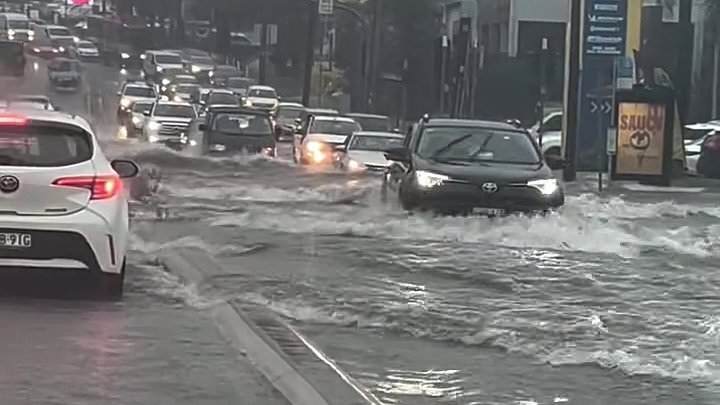
Cars were seen ploughing through high floodwaters in Marrickville in the city’s inner west.
The roads were also inundated in Riverstone, north-west Sydney.
And the town of Harden, in regional NSW, was left covered in piles of large hail stones.
Foxtel was down for residents across the city due to the storm, interrupting Super Bowl coverage for local fans.
Bureau of Meteorology senior meteorologist Gabrielle Woodhouse told Daily Mail the rain bomb was the result of a trough and an upper-level trough that combined over Sydney.
‘It was so severe because we’ve got a lot of moisture through the depth of the atmosphere.
‘For the rest of today (Monday) there’s still a chance of showers or storms, but not as significant as the one in the middle of the day.’
Looking ahead to Tuesday, Ms Woodhouse said ‘there is a chance we could see severe storms tomorrow, it’s one of the things we’ll have to monitor’.
Below is the outlook for the next few days.
Sydney
Monday: Showers. Possible storm. Max 27
Tuesday: Showers. Possible storm. Min 19 Max 27
Wednesday: Shower or two. Min 21 Max 28
Brisbane
Monday: Shower or two. Max 31
Tuesday: Shower or two. Min 22 Max 31
Wednesday: Shower or two. Min 23 Max 29
Melbourne
Monday: Partly cloudy. Max 26
Tuesday: Partly cloudy. Min 18 Max 31
Wednesday: Sunny. Min 19 Max 34
Hobart
Monday: Cloudy. Max 21
Tuesday: Possible shower. Min 15 Max 23
Wednesday: Partly cloudy. Min 17 Max 31
Adelaide
Monday: Sunny. Max 34
Tuesday: Sunny. Min 21 Max 37
Wednesday: Mostly sunny. Min 25 Max 42
Perth
Monday: Partly cloudy. Max 28
Tuesday: Shower or two. Becoming windy. Min 20 Max 25
Wednesday: Cloud clearing. Min 15 Max 27
Canberra
Monday: Showers. Possible storm. Max 23
Tuesday: Showers. Min 14 Max 25
Wednesday: Shower or two. Min 15 Max 27