A powerful high-pressure system parked over southeastern has triggered a week of icy temperatures, just ahead of the year’s shortest and darkest day of the year.
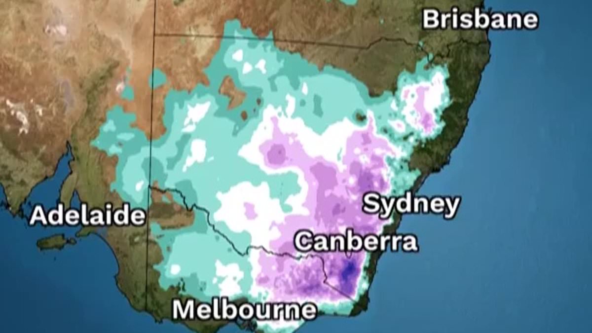
Clear skies have spread across New South Wales and Victoria, with the system expected to keep clouds away into the weekend.
While the days are sunny and mild, the nights have turned bitterly cold, leading to widespread frost and sub-zero temperatures.
The Bureau of Meteorology’s Jonathon How explained the system can cause cool mornings.
‘We’ve got high pressure sitting on top of us which basically means sinking air, sinking air generally clears skies, number one,’ he told Daily Mail .
‘Number two, it brings dry air down to the surface and that can mean cold nights.’
Dry air, which contains less water vapor, traps less heat, allowing temperatures to plunge overnight.
On Thursday morning, regions along the Great Dividing Range – from Victoria to Queensland – recorded temperatures below -4C. Marrangaroo, west of Lithgow in NSW, saw the coldest reading at a bone-chilling -7.7C.
Frosts are forecast to continue across NSW, Victoria, Tasmania’s highlands, eastern South , and parts of Queensland and the Northern Territory, including Roma and Alice Springs.
The cold snap is expected to ease slightly over the weekend as the high-pressure system begins to move offshore.
‘Overnight temperatures will gradually start to climb again and it won’t be as icy,’ Mr How said.
Sydney’s overnight lows could rise from 6C to 13C by late next week, thanks to a front bringing warmer northerly winds.
The timing coincides with the winter solstice on Saturday, marking the darkest and shortest day of the year.
‘You’ve got long nights and the longer the darkness the more that heat can leave the Earth’s surface,’ he said.
‘And you’ve got less daytime to warm it up again. So we’ve really been approaching the coldest time of the year.’
Hobart will see the least daylight of all capital cities – just nine hours and one minute. Sydney will get 9 hours and 54 minutes, while Darwin, being furthest north, will enjoy 11 hours and 24 minutes.
Meanwhile, in the west, Perth braces for wet and windy weather as another cold front rolls in from the ocean, bringing rain, thunderstorms, and gusty winds.
Canberra
Friday: Morning frost. Mostly sunny. Min -5C. Max 13C.
Saturday: Morning frost. Sunny. Min -4C. Max 15C.
Sunday: Morning frost. Mostly sunny. Min -4C. Max 14C.
Sydney
Friday: Mostly sunny. Min 6C. Max 17C.
Saturday: Sunny. Min 7C. Max 18C.
Sunday: Sunny. Min 8C. Max 19C.
Brisbane
Friday: Partly cloudy. Min 13C. Max 23C.
Saturday: Partly cloudy. Min 14C. Max 23C.
Sunday: Partly cloudy. Min 15C. Max 24C.
Melbourne
Friday: Sunny. Min 6C. Max 16C.
Saturday: Sunny. Min 5C. Max 16C.
Sunday: Sunny. Min 6C. Max 16C.
Hobart
Friday: Partly cloudy. Min 8C. Max 17C.
Saturday: Mostly sunny. Min 7C. Max 17C.
Sunday: Mostly sunny. Min 7C. Max 15C.
Adelaide
Friday: Sunny. Min 9C. Max 19C.
Saturday: Sunny. Min 9C. Max 19C.
Sunday: Shower or two. Min 10C. Max 22C.
Darwin
Friday: Sunny. Min 20C. Max 31C.
Saturday: Mostly sunny. Min 21C. Max 31C.
Sunday: Mostly sunny. Min 20C. Max 30C.
Perth
Friday: Rain increasing. Min 13C. Max 21C.
Saturday: Showers. Min 8C. Max 17C.
Sunday: Showers. Min 9C. Max 19C.
Sydney – Sunrise: 7am – Sunset: 4.54pm – Day Length: 9h 54m
Melbourne – Sunrise: 7.35am – Sunset: 5.08pm – Day Length: 9h 33m
Brisbane – Sunrise: 6.37am – Sunset: 5.02pm – Day Length: 10h 25m
Perth – Sunrise: 7.16am – Sunset: 5.20pm – Day Length: 10h 4m
Adelaide – Sunrise: 6.53am – Sunset: 4.42pm – Day Length: 9h 49m
Canberra – Sunrise: 7.12am – Sunset: 4.58pm – Day Length: 9h 46m
Hobart – Sunrise: 7.42am – Sunset: 4.43pm – Day Length: 9h 1m
Darwin – Sunrise: 6.36am – Sunset: 6.00pm – Day Length: 11h 24m