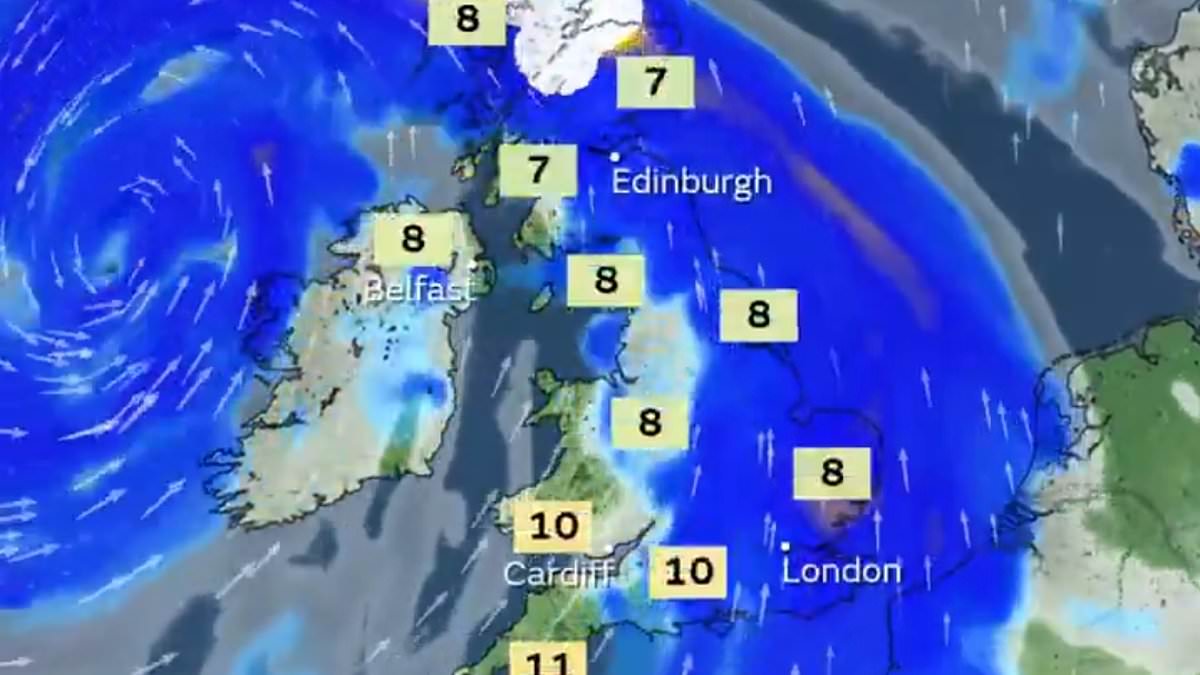
Storm Éowyn was named by the Met Office today as 80mph winds are set to cause chaos across the UK this Friday along with torrential rain and snow.
The fifth named storm of the 2024/25 season comes after Darragh on December 6, Conall on November 27, Bert on November 22 and Ashley on October 20.
A yellow wind warning in Scotland and northern England was first imposed yesterday, running from midnight on Friday to midday on Saturday.
Then, the Met Office updated the warning this morning to include most of the UK excluding London and the South East of England.
Unsettled conditions will begin to arrive on Thursday and will see strengthening winds and heavy rainfall in western parts of the country overnight.
It follows the ‘benign’ grey, cloudy weather and outbreaks of rain seen by much of the country at the start of this week.
The 80mph winds will batter the highlighted areas of Britain on Friday and Saturday as gusts are pushed across the country by a supercharged Atlantic Jet Stream.
The Met Office said the ‘very strong’ south-easterly to south-westerly winds could cause damage to buildings, public transport disruption, road or bridge closures and power cuts – while ‘injuries and danger to life could occur from flying debris’.
And it urged those in the warning area: ‘Prepare to protect your property and people from injury. Check for loose items outside your home and plan how you could secure them. Items include; bins, garden furniture, trampolines, tents, sheds, and fences.’
Inland areas could see wind speeds reach 50 to 60mph and around western coastal regions, gusts may reach between 70 and 80mph.
In the last few days, the Jet Stream has been weak and spread out allowing high pressure to linger close by, preventing any powerful weather incidents.
However, this is set to change on Thursday as a strong temperature contrast from the clash of frosty Arctic air surging southwards across North America and much milder tropical air further south of the world ‘supercharges’ the Jet Stream.
The Jet Stream will develop above the North Atlantic, with core wind speeds predicted to exceed 260mph, as the Met Office predicts ‘perhaps the strongest winds of the winter so far’ by Friday.
The powerful injection of energy high up in the atmosphere will cause an area of low pressure to deepen rapidly as it makes its way to Britain bringing gales and the threat of disruption on Friday and Saturday.
Torrential downpours are also expected to hit the north-west of the country with temperatures remaining cold enough for snow to fall over hills in Scotland, northern England and Northern Ireland.
Storm Éowyn will bring a longer period of more turbulent conditions with computer models suggesting further deep areas of low pressure could pass close to the UK next week.
Grey clouds are set to cover much of the UK today and Wednesday with more rain expected in some northern parts of England, Wales and northern Scotland.
Many commuters across the country were met with thick blankets of low hanging fog as they made their way to work this morning.
The major weather shift on Thursday will see a front bringing heavy downpours as it travels eastwards throughout the day.
The highest accumulations of heavy rainfall are expected in North Wales and Northwest England where 20-30mm could fall over the hills with some possibility of snow over the Scottish mountains.
The strongest gales are predicted to hit Northern Ireland and western Scotland on Friday, where speeds could reach above 80mph along coastlines and high ground.
As the weather warning was issued five days in advance, it is likely to be updated with further information over the coming days as more accurate data becomes available.
The Met Office predicts Saturday will remain ‘a breezy day everywhere with strong winds persisting in the north’ as Storm Éowyn weakens and clears to the northeast.
Lighter showers will replace persistent heavy downpours in many areas of the country.
However, on Sunday, another area of low pressure could bring another spell of wet and very windy weather across the UK.
