A winter-like weather system is set to plunge ‘s southeast into a cold snap – with snow set to fall on the Tasmania and Victorian Alps.
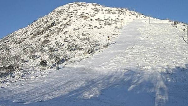
The dusting of snow is predicted to hit the Tasmanian and southern Victorian alps on Saturday night and into Sunday morning, 7News meteorologist Jane Bunn said.
The system is set to see temperatures plunge in Melbourne to 20C by Saturday afternoon, despite temperatures soaring to 30 degrees today.
This weekend, Hobart is set to peak at only 16C, while Adelaide, which hit the low 40s on Wednesday, will see a significant drop to the low 20s by the weekend.
Bunn said the cold weather will continue through much of next week.
‘A large part of the country will experience maximum temperatures several degrees below average — in some cases as much as 5 or 6C,’ she explained.
‘When there is snow falling in the alps, those of us in the towns and cities shiver, and it’ll be quite a shock after the stretch of heat.’
Bunn said cold air from Antarctica was behind the unusual summer snow phenomenon, but it was not entirely unheard of.
In December 2013, an exceptionally cold front swept through, covering Perisher in NSW with a heavy blanket of snow.
This weather system doesn’t look quite as strong, but should provide a dusting of snow on the Tasmanian and southern Victorian alps on Saturday night into Sunday morning.
On the east coast, Sydney is expected to have a cloudy weekend, with temperatures reaching 24C on Saturday and 20C on Monday.
Brisbane will remain hot over the weekend, with 30C on Friday, 31C on Saturday with a chance of a thundershower, and 33C on Sunday.
Another hot and sunny weekend is in store for Perth, hitting 32C on Friday, 35C on Saturday, and 32C on Sunday.
Meanwhile, the port at Port Hedland has shut down as Tropical Cyclone Zelia approached Northern WA.
The system was likely to develop into a damaging category three cyclone before crossing the Pilbara or west Kimberley coast from Friday, the Bureau of Meteorology said.
Destructive wind gusts of up to 220km/h could develop between Whim Creek and Wallal Downs as the system crept closer to the coast.
BHP paused non-essential travel to Port Hedland while iron ore mines continued to operate.
Authorities worked with retailers to ensure supplies were available to rural, Indigenous and isolated communities, with the cyclone tracking toward the east Pilbara coast.
Additional on-the-ground personnel, flood boats and aircraft have also been pre-deployed.
An evacuation centre is expected to be open at Port Hedland when warnings are upgraded to ‘watch and act’.
The storm is expected to bring rainfall totals in excess of 500mm to the region.
Residents in a warning zone spanning from Bidyadanga to Dampier have been urged to monitor updates.
Major roads and arterial routes are expected to be impacted for up to a week in northern WA.
Meanwhile, a clean-up is continuing in north Queensland after nearly two weeks of flooding that claimed two lives and forced hundreds to evacuate.
The danger has not passed, with flood warnings and watches still in place across the region.
However, the record rainfall that isolated communities, closed schools, and damaged roads has finally eased.