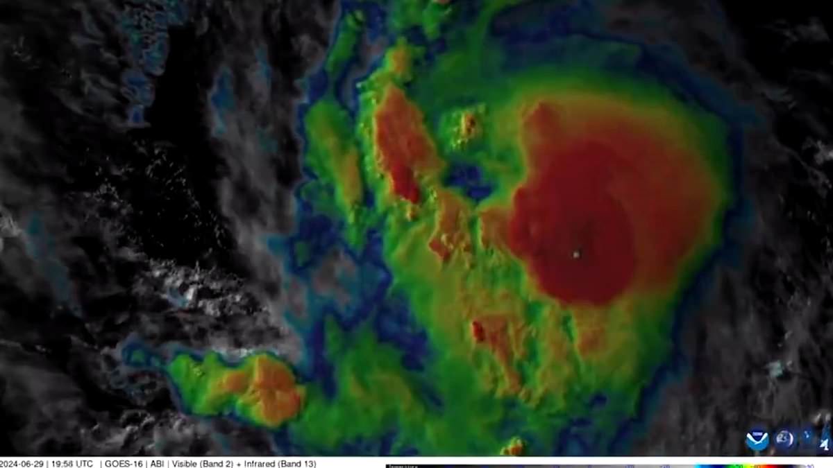
A ‘rapidly strengthening’ major hurricane has formed in the Atlantic Ocean – marking the first such storm of the season.
Hurricane Beryl quickly intensified into a major hurricane – strengthening from a tropical depression into a tropical storm and then a hurricane within just 24 hours, Fox Weather reports.
It is now expected to bring life-threatening storm surges to the Windward Islands – including Grenada, St. Vincent, St. Lucia and Dominica – starting Sunday night, the National Hurricane Center announced Saturday.
Hurricane watches and warnings are already in effect for those areas, as the storm barrels towards the islands with wind speeds of up to 80mph, according to Backpirch Weather , which called it ‘unreal.’
Despite the growing alarm over it increasing strength, it is not likely that Hurricane Beryl will make landfall on the U.S.
As of Saturday night, Beryl’s center was about 720 miles southeast of Barbados, meteorologist James Spann posted on X.
Once it hits landfall on the island, the storm surge could reach five to seven feet above normal tides.
It will also bring ‘large, destructive waves’ and rainfall of three to six inches, according to the National Hurricane Center.
Beryl is then expected to move into southeastern Puerto Rico by Monday night and into Tuesday, bringing with it one to four inches of rain.
At that point, it is expected to have peak winds of up to 120mph – making it a Category 3 hurricane, USA Today reports.
By Wednesday afternoon, Beryl should be in the vicinity of Jamaica, and by the end of the week, its center could be near the Yucatan Peninsula or Central America – though it remains unclear whether the storm system will enter the Gulf of Mexico.
‘Direct impacts to the United States look unlikely; however it is very important to note that if the high pressure across the southeast weakens, that can allow the storm to move farther north and potentially directly impact the Gulf Coast,’ Accuweather Lead Hurricane Forecaster Alex DaSilva said.
Meteorologists currently differ on whether the storm will lose strength as it continues to make its way across the Caribbean.
Spann suggested that ‘an increase in shear should end the strengthening trend and induce some weakening toward the end of the forecast period,’ he explained.
Accuweather meteorologists, however, expect the impact of the shear to be minimal – and say Beryl could actually intensify due to higher-than-average water temperatures, becoming a major hurricane by Monday.
The hurricane has already broken records, as it formed earlier in the season than most storm systems.
The average date for the first hurricane of the summer is August 11, Fox reports.
And even of those that have formed in June, Beryl has formed the furthest east in the Atlantic ocean since records began in the mid-1800s.
The previous record was held by Hurricane Two, which formed in 1933 off the coast of South America.
But Beryl could soon be followed by two other storm systems.
One such system has formed east of Beryl and ‘is expected to follow a track very similar’ to the hurricane, meteorologist DaSilva predicts.
It could be around the Lesser Antilles around July 3 and 4, and ‘could eventually bring very heavy rain to portions of the Greater Antilles.’
A third storm is also being monitored closer to the United States.
It is currently over the Yucatan Peninsula, and can cause flooding and mudslides across northeastern Mexico starting Sunday night.
