Britain is bracing for a weather double-whammy as the Met Office issues six separate warnings for thunderstorms, torrential rain, hail, and flash floods.
While in contrast other parts of the UK are simultaneously plunged into official drought after the driest spring in over a century.
Forecasters say the next three days will bring wild swings between tropical heat and violent downpours, with temperatures soaring to 30C on Friday, potentially making it the hottest day of 2025 so far, hotter than Ibiza, Mykonos, and even sunny Los Angeles.
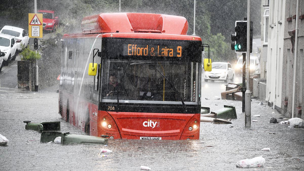
The Met Office warned that some areas could be hit by up to two inches of rain in just a few hours, with gusty winds reaching up to 50mph, lightning strikes, hail, and the risk of flooding and travel chaos.
In a further blow, the UK Health Security Agency (UKHSA) has issued its first yellow heat-health alert of the year, running from 9pm Thursday to 8am Sunday.
It covers London, the East Midlands, the South East and East of England where vulnerable people face health risks and hospitals could come under strain.
‘It’s all because we’ve got air moving in from the south, so the air is originating across Spain and Portugal and has been moving its way northwards,’ said Met Office forecaster Simon Partridge.
‘We’re going to see increasingly humid conditions with very warm days and some quite muggy nights as well and the general gist is that western parts of the UK are likely to see the majority of the rain and the thundery showers.
‘But, as we go into Friday, we could see some of that also moving across the east and south east as well for some thunder there for a time.’
Thursday sees the first round of storms hitting Northern Ireland, South West England and Wales, with the Met Office predicting flash floods, power cuts and major travel disruption.
Another round rolls in Friday evening, slamming south-east England and London with up to 50mm of rain in a matter of hours.
The violent storms could unleash hail, lightning, and gusty winds, while heavy cloud cover and high humidity will keep things sweltering and uncomfortable overnight.
Despite the washouts, Friday could still hit a scorching 30C, depending on how much sunshine breaks through the haze.
The Met Office has six weather warnings currently in place:
• South West England and Wales: 00:00–19:00 Thursday
• Northern Ireland: 06:00–21:00 Thursday (rain)
• South West England and Wales again: 18:00–23:59 Friday
• South East England: 15:00 Friday – 06:00 Saturday
• Western England, Wales and Southern Scotland: 00:00–18:00 Saturday
Rainfall could top 10–20mm in just one hour, raising fears of flash flooding, especially in urban areas already parched from an unusually dry spring.
Amid all the chaos, the Environment Agency has officially declared a drought in Yorkshire, where some areas have seen less than 50 percent of average rainfall this spring and just three-quarters of the May average.
It follows a similar move in north-west England last month, and a developing drought zone in parts of the Welsh Water network.
The agency warned that the prolonged dry period has drastically reduced water supplies and could pose a serious risk to wildlife, agriculture, and public health. Hosepipe bans and water restrictions may be introduced if the situation worsens.
A spokesperson said: ‘A drought is a prolonged dry period that reduces available water supplies and can negatively impact the environment, people and wildlife.’
Friday’s storms are expected to form into long bands, bringing torrential rain, strong winds, hail and lightning especially across eastern and south-eastern England.
Simon Partridge added: ‘We’ve got a very warm, humid, spell of wet weather to come.’
Under the UKHSA’s alert system, the yellow alert signals a likely increase in healthcare demand, particularly from over-65s and people with heart or lung conditions.