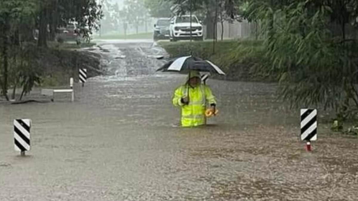
Thousands of Aussies are being warned to get to high ground or evacuate the city by midday as north Queensland battles heavy rain, flooding and strong winds.
Widespread rainfall fuelled by tropical lows around north Queensland has led to warnings of dangerous and life-threatening flooding reaching up to two storeys after a days-long deluge.
Heavy rain continues to impact areas of the Herbert and Lower Burdekin and North Tropical Coast, extending from Mackay to south of Cairns.
The rainfall has been fuelled by two tropical lows, which are unlikely to form into cyclones.
An emergency warning was issued at 5am on Sunday for the Hinchinbrook Shire with authorities warning residents to stay in place.
‘Get up as high as you can where you are. There is dangerous flooding,’ it warned.
Another emergency alert was issued for greater Townsville, with residents of Cluden, Hermit Park, Idalia, Oonoonba, Railway Estate and Rosslea warned to leave by midday on Sunday.
It’s believed the flooding may exceed levels experienced in March 2018 at Ingham Pump Station, Halifax, Gleneagle, Abergowie Bridge and Gairloch.
However, cyclonic-like rain totals have lashed Townsville and surrounds with forecasts of 200mm to 400mm expected through Sunday into Monday.
The forecast falls come after isolated seven-day totals of more than 900mm hammered the North Tropical Coast.
The Bureau of Meteorology said the weekend rainfall could lead to flooded homes, businesses and properties, landslides and further road closures.
‘We’re likely to see widespread falls of anywhere from 200 to 400 millimetres almost on a daily basis, with isolated falls in excess of 900 millimetres possible,’ senior meteorologist Dean Narramore said.
‘We could even be talking about places in excess of one metre over the next few days. That is an incredible amount of rainfall.’
A severe weather warning is current from Innisfail to Ayr, south of Townsville.
A disaster declaration has been made for both Townsville and Innisfail.
Authorities have deployed further resources to the state’s north with the n Defence Force assisting on the ground.
‘The next 24 hours it is absolutely critical that you listen to emergency services and stay alive to the alerts,’ state disaster co-ordinator Shane Chelepy said on Saturday.
‘We are dealing with a dual event here.
‘We are dealing with flash flooding from the heavy rain, but we are now seeing impacts from those major riverine systems which will bring riverine flooding into those communities.’
Townsville experienced its largest rainfall weather event in 120 years in January and February 2019.
About 3,300 homes were damaged by floodwaters and about 1,500 homes rendered uninhabitable.
Prepare-to-leave warnings were issued on Saturday for six suburbs in the city – Cluden, Hermit Park, Idalia, Oonoonba, Railway Estate and Rosslea.
An evacuation centre is open at Heatley for affected residents.
Local worker Matthew James said he had seen first-hand how much damage torrential rain could produce.
‘I still now am seeing places that have either just finished being repaired or completely refurbished after the 2019 floods,’ he told AAP.
‘So you can imagine if you lived in one of those houses that flooded, you’d probably be thinking now you might be in trouble.’