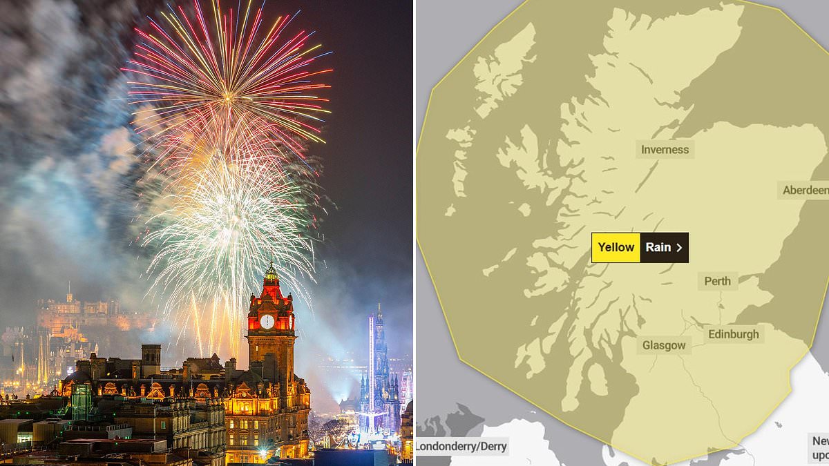
Revellers are set for a Hogmanay washout after forecasters warned of ‘significant disruption’ because of torrential rain, strong winds and snow.
A yellow weather warning has been issued as more than five inches of rain could fall in 48 hours, causing a possible ‘danger to life’.
High winds will also batter much of Scotland and there could be ‘heavy snowfall’ as 2024 comes to a stormy end.
The weather is likely to cause problems for organisers of outdoor New Year celebrations and could disrupt the transport network.
Motorists will face challenging driving conditions and there could be delays or cancellations to train and ferry services.
The Met Office has said that further weather warnings are expected to be issued.
The yellow warning put out yesterday for heavy rain comes into force at midnight on Sunday and lasts until midnight on New Year’s Eve.
It covers all of Scotland except Orkney and Shetland, and could dampen the spirits of the 45,000 revellers planning to see in 2025 at Edinburgh’s famous Hogmanay Street Party.
Most places will have around 2.5 inches of rain during Monday and Tuesday but the total could be double that in the west, bringing a risk of flooding.
The weather warning states: ‘Rain is likely to become persistent and occasionally heavy on Monday and possibly last through New Year’s Eve.
‘This may bring some significant disruption and flooding in the build up to new year events, although there is still a lot of uncertainty in which areas are likely to be affected.
‘Widespread totals of 50 to 70mm are possible over the two days with some places perhaps seeing 100 to 140mm of rain.
‘These higher totals are most likely over western Scotland. Snow may present an additional hazard, especially in the north of Scotland and over high ground.
‘Strong winds could also bring further disruption, particularly on Tuesday.’
Hillwalkers will encounter heavy snow in the mountains and there could also be snow at lower levels, especially in the north.
Met Office Chief Forecaster Neil Armstrong said: ‘From Sunday we will start to see some heavy rain affecting northwestern parts of Scotland.
‘After a brief respite, further rain and strong winds will be in place on Monday and Tuesday across Scotland, as another area of low pressure approaches.
‘This may be accompanied by some heavy snowfall in the mountains and perhaps to lower elevations.’
Sleet and snow will be more likely to become widespread in the first days of 2025, and could cause problems for people travelling home after the festive break.
Tony Wisson, a deputy chief meteorologist, added: ‘Later in the week, wintry showers are likely to be a feature of the forecast as a cold northerly flow becomes established.’
But forecasters are still unsure which areas will be worst hit next week and are still working to establish the most likely path of the approaching weather fronts.
They have urged people to check the forecast before embarking on journeys or planning outdoor activities such as a day out in the hills.
Mr Armstrong said: ‘With such varied and potentially fast-moving weather conditions it is important for people to keep up to date with the forecast.’]#
A spokesperson for Edinburgh’s Hogmanay said: ‘We continue to work closely with the MET Office and other agencies to monitor forecasts in the days leading up to Hogmanay.
‘As always in Scotland, the forecasts are changing regularly, and we are still a few days away, so we advise customers to stay up-to-date via our social channels and MET Office.
‘For all Edinburgh’s Hogmanay outdoor events, we recommend audiences dress appropriately for winter events in Scotland- prepare for all weather, wrap up warm and double check with your travel operator for the latest updates.’
