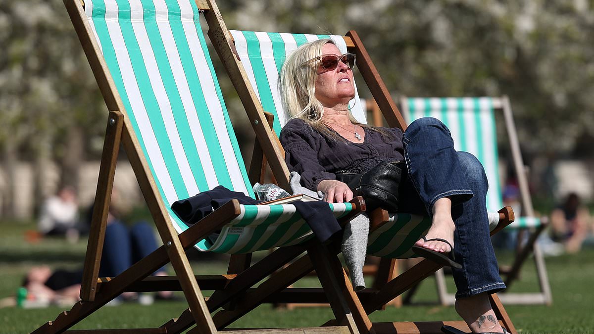
Britain is set to bask in a a mini-heatwave next week with temperatures expected to reach a balmy 25C by Wednesday.
London will enjoy these sunniest forecasts by around 4pm that day – which would be the warmest weather of the entire year so far.
The hottest day of the year to date was April 12, when the Northolt area of north west London reached a summery 24C.
The temperature has not reached 25C in April since 2020, as the UK went into lockdown – with the mercury normally only getting so high in mid to late May in recent years.
Luckily, for those running the London and Manchester marathons on Sunday, the weather will also be dry and sunny towards the end of the weekend.
In London, temperatures will start at 13C and climb to 20 or 21C by mid-afternoon – while Manchester will be slightly cooler due to a south-westerly breeze with temperatures peaking at 17C.
But as the wind direction slowly changes early next week, temperatures will sharply climb to about 22-23C.
The warm weather should last until at least the end of next week because of a blocked weather pattern drawing up heat from continental Europe.
The peak in temperatures due in the middle of next week will be the warmest weather Britain has enjoyed since early September last year.
But by the end of next week, cooler weather might be seen in northern parts of the UK and showers could affect southern areas.
This month is synonymous with rain, with average temperatures for this time of year normally around the 13C mark – which next week’s mini-heatwave will outstrip by up to 12C.
While Londoners will enjoy the hottest temperatures, places across the south-east and the Midlands will enjoy a pleasant 24C midweek too.
Brighton, Rochester, Swindon, Cambridge, Peterborough, Banbury, Nottingham and Lincoln will be basking in these glorious temperatures.
Most other areas of England and Wales will enjoy around 22C or 23C, moving down a notch to 21C heading north up to Dumfries, Edinburgh and Glasgow.
Parts of Scotland will still be a little chilly, even during that midweek peak point though, with parts of the west of the country at a slightly parky 12C.
The hottest April on record was in 1949, when London reached a sizzling 29.4C.
It comes after Brits flocked to the seaside and beer gardens earlier this month on what was the warmest day of the year so far.
Temperatures on April reached up to 24C, with the capital enjoying a pleasant 22C while parts of the southeast and southwest basked in 20C sunshine.
But with warmer weather comes risks to sightseers – idiotic daytrippers were spotted standing inches from death as they peered over the crumbling cliffs at a popular East Sussex viewpoint earlier this month.
Tourists were seen standing dangerously close to the cliff edge in the coastal hamlet of Birling Gap, one of Britain’s most popular beauty spots.
It comes as the National Trust, which manages the attraction, bans coaches from visiting it in a bid to reduce the ‘tsunami of tourists’ and limit damage to the natural environment.
Up to 600,000 visitors a year flock to this stretch of the legendary Seven Sisters chalk cliffs – with non-stop sightseeing tours wrecking the grassland, paths and verges.
The ban is said to be the first of its kind that the Trust has imposed on one of its attractions – and follows a council warning against straying too close to the cliff edge.
It has raised fears that the Trust’s move could be a precursor to similar action in other hotspots, including the Cotswolds and the Lake District.
Overnight:
Rain moving across Northern Ireland and into the west of Scotland and Cornwall overnight. Dry elsewhere with some clear spells – but low cloud in many central and eastern areas. Patchy mist, fog and grass frost under clearer skies.
Today:
Rain and a southerly breeze in Northern Ireland and some other western areas. Dry elsewhere with lighter winds. Early low cloud breaking to give some warm spells of sunshine.
Saturday to Monday:
Patchy rain moving east across Scotland, England and Wales on Saturday. Bright either side of this.
Wet and breezy in the north on Sunday – but otherwise settling into warm sunshine.